Daily Risk Forecast Maps
Forecast issued by the Met Office at 10:30am, Monday 6th May
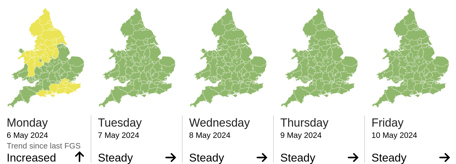
The river flood risk is VERY LOW for the next five days.
Minor river flooding impacts are possible but not expected for parts of England today (Monday). This is due to the potential for some heavy thundery showers. See Specific Areas of Concern Map.
The coastal/tidal flood risk is VERY LOW for the next five days.
The surface water flood risk is LOW today (Monday).
Significant surface water flooding impacts are possible but not expected across parts of England and Wales today, with minor impacts possible more widely. This is due to the potential for heavy, thundery showers. See Specific Areas of Concern Map.
Impacts could include localised flooding from urban and fast responding smaller watercourses/catchments, drains, channels and flooding from overland flow.
The groundwater flood risk is VERY LOW for the next five days.
The level of the ongoing disruption caused by groundwater flooding in the South of England is not forecast to get worse, the flooding is being managed and awareness is high. Consequently the groundwater flood risk is VERY LOW.
Cheshire, Denbighshire, York, Stoke-on-Trent, S Yorkshire, W Yorkshire, Merseyside, Shropshire, Halton, Derbyshire, Blackburn with Darwen, Nottinghamshire, Powys, Gwynedd, Wrexham, Flintshire, Lancashire, Warrington, Staffordshire, Gtr Manchester, Conwy, E Riding of Yorkshire, Durham, Middlesbrough, Tyne and Wear, Darlington, N Yorkshire, Stockton-on-Tees, Northumberland, Hartlepool, Cumbria, Redcar and Cleveland
Source and risk of potential flooding
Additional information: Local torrential showers may lead to significant surface water flood impacts
Gtr London, Poole, Portsmouth, Southampton, Hampshire, Dorset, Bournemouth, Isle of Wight, Medway, W Sussex, E Sussex, Surrey, Kent, Brighton and Hove
Source and risk of potential flooding
Additional information: Some locally heavy downpours may lead to significant flood impacts
Durham, Tyne and Wear, Middlesbrough, Darlington, Hartlepool, Stockton-on-Tees, Conwy, Northumberland, Denbighshire, Merseyside, Halton, Blackpool, Flintshire, Swansea, Bedfordshire, Rutland, Derby, Norfolk, York, Bristol, W Yorkshire, Torfaen, Caerphilly, Shropshire, Northamptonshire, Gloucestershire, Blackburn with Darwen, N Yorkshire, Powys, Leicestershire, Essex, Telford and Wrekin, Leicester, Lancashire, W Berkshire, Ceredigion, Peterborough, Warrington, Lincolnshire, Warwickshire, Bridgend, Gtr Manchester, Buckinghamshire, NE Lincolnshire, Oxfordshire, Wiltshire, Worcestershire, Neath Port Talbot, Redcar and Cleveland, Merthyr Tydfil, Cheshire, Luton, Stoke-on-Trent, S Yorkshire, N Somerset, Cumbria, Nottingham, Hertfordshire, Cardiff, Newport, S Gloucestershire, Derbyshire, Carmarthenshire, Rhondda Cynon Taff, Herefordshire, Nottinghamshire, Suffolk, Gwynedd, Wrexham, Vale of Glamorgan, Monmouthshire, Staffordshire, Blaenau Gwent, Cambridgeshire, Bath and NE Somerset, Milton Keynes, E Riding of Yorkshire, Kingston upon Hull, W Midlands, Swindon, N Lincolnshire
Source and risk of potential flooding
Additional information: Heavy showers may lead to some flood impacts