📢 Please take a minute to read this personal message from the creator of River Levels UK

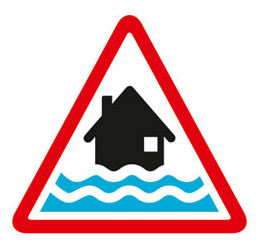
Flooding expected. Take action now.
High tides, strong winds and large waves are expected to cause flooding tomorrow.
Flooding is expected 3 hours either side of high tides
Areas at risk include exposed coastal areas at Hallsands, Beesands, Torcross, Slapton, Blackpool Sands, Teignmouth Promenade and Dawlish. The high tide at Teignmouth on Sunday morning is at 04:15. Forecast total high tide level is 2.14mAOD, which is 0.56 metres above tide table level. Strong force 6 South Easterly winds and offshore wave heights of over 2.1m are forecast over the high tide. High tide on Sunday evening is at 16:30. Forecast total high tide level is 2.15mAOD, which is 0.4 metres above tide table level. Strong force 6 Easterly winds and offshore wave heights of over 2m.
We are closely monitoring the situation .
Avoid coastal roads, footpaths and carparks, which may be flooded.
This message will be updated by 2:00PM on Sunday 22 November or as the situation changes.
Information supplied by the Environment Agency
Message issued at 3:18pm, Saturday 21st November 2026.
This page is a dedicated URL for a specific message issued at a particular time. You should not bookmark this page, as the current situation may have changed since this message was issued.
Flood warning
Sat 21 Nov 2026, 3:18pm
Warning no longer in force
Fri 23 Oct 2026, 12:21pm
Flood warning
Thu 22 Oct 2026, 12:20pm
Warning no longer in force
Thu 30 Apr 2026, 1:39pm
Flood warning
Wed 29 Apr 2026, 1:35pm
Warning no longer in force
Thu 23 Apr 2026, 5:13pm
Flood warning
Thu 23 Apr 2026, 9:51am
Flood warning
Wed 22 Apr 2026, 2:48pm
Flood warning
Tue 21 Apr 2026, 2:06pm
Warning no longer in force
Thu 19 Feb 2026, 1:11pm
Exposed coastal areas at Hallsands, Beesands, Torcross, Slapton, Blackpool Sands, Teignmouth Promenade and Dawlish
Region: Devon and Cornwall
Country: England
Counties covered: Devon, Torbay
Watercourses covered: English Channel, South Devon Coast
The area bounded in blue on the map shows the area covered by flood alerts and warnings for South Devon coast at Beesands, Torcross, Slapton and Dawlish.
Note: the area shown on the map is the area covered by flood alerts and warnings. It is not a live map of current flooding. The area covered broadly equates to the area where the risk of flooding in any year is greater than 1% (the "hundred year" flood risk).

No current or recent warnings.