📢 Please take a minute to read this personal message from the creator of River Levels UK

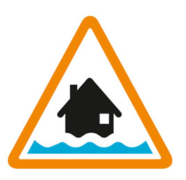
Flooding possible. Be prepared.
Forecast high river levels on Sunday may lead to flooding.
Flooding is possible from the early hours of Sunday 22 November
River levels are high, and further prolonged rainfall is expected from Saturday evening through to Sunday night. A band of rain is expected to become slow-moving across southwest England from the early hours of Sunday, with the potential for heavier and more persistent rainfall to develop.
The following gauge is forecast to reach Flood Alert criteria: Pillaton.
We are closely monitoring the situation .
Take care and avoid walking, cycling or driving through flood water.
This message will be updated by 11:00AM on Sunday 22 November or as the situation changes.
Information supplied by the Environment Agency
Message issued at 12:52pm, Saturday 21st November 2026.
This page is a dedicated URL for a specific message issued at a particular time. You should not bookmark this page, as the current situation may have changed since this message was issued.
Flood alert
Sat 21 Nov 2026, 12:52pm
Warning no longer in force
Sat 31 Jan 2026, 10:57am
Flood alert
Fri 30 Jan 2026, 1:29pm
Flood alert
Thu 29 Jan 2026, 2:41pm
Flood alert
Wed 28 Jan 2026, 2:22pm
Flood alert
Tue 27 Jan 2026, 11:48am
Flood alert
Mon 26 Jan 2026, 11:09am
Flood alert
Sun 25 Jan 2026, 11:29am
Flood alert
Sat 24 Jan 2026, 12:13pm
Flood alert
Fri 23 Jan 2026, 1:41pm
Rame Peninsula, Callington, Saltash, Rilla Mill, Pillaton and Landrake
Region: Devon and Cornwall
Country: England
Counties covered: Cornwall
Watercourses covered: River Lynher
The area bounded in blue on the map shows the area covered by flood alerts and warnings for River Lynher.
Note: the area shown on the map is the area covered by flood alerts and warnings. It is not a live map of current flooding. The area covered broadly equates to the area where the risk of flooding in any year is greater than 1% (the "hundred year" flood risk).

No current or recent warnings.